Our planet is constantly changing as a result of natural events like earthquakes, volcanoes, tsunamis, and storms, and other times because of human beings. Today we invite you to take a journey through, time and space, to see how some corners of our beloved Earth have been transformed in recent decades. Unfortunately, most of these changes are a result of human activity. But we’re still on time to change that, and, in fact, there are a few pictures in our compilation that prove it.
Bright Side prepared a compilation of images captured by Google Earth to show you the most impressive changes suffered by our planet in the last 40 years. Hopefully, we’ll raise awareness of the topic and help others understand how important taking care of Mother Nature is.
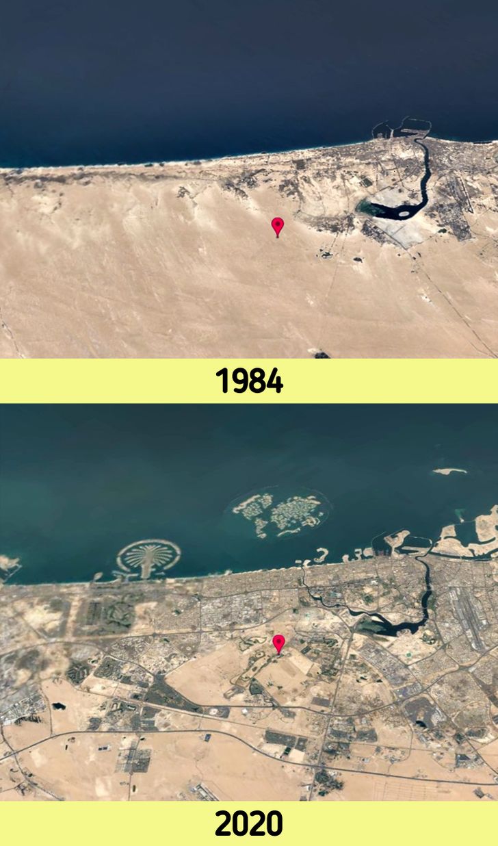
1. New islands appeared on the map: Dubai’s Palm Islands
© Google Earth
The city of Dubai has undergone a tremendous expansion in recent years. In terms of population, it actually grew from about 500,000 inhabitants (1990) to more than 3.3 million (2020). The city, known to be one of the most prominent business centers in the world, has grown considerably in terms of surface as well. It has spread over more than 300 kilometers of coastline and inland, both on land and at sea. This led to the creation of a cluster of man-made islands, the Palm Islands and The World Archipelago.
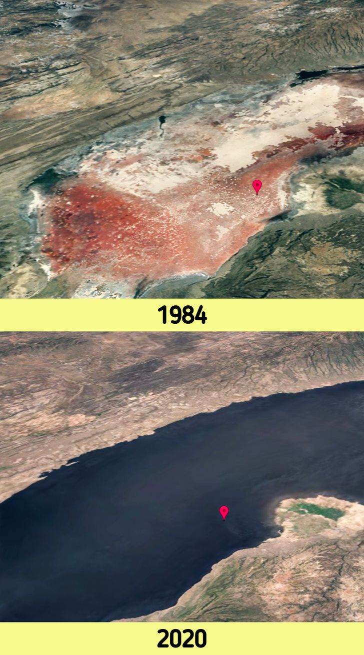
2. Color-changing waters: Lake Natron, Tanzania
© Google Earth
At first glance you might think that what you’re looking at in the first picture of the collage above is land. However, it’s a pink lake. Due to its high salinity, temperature of more than 40°C (104 °F), and an alkalinity that can reach a pH of greater than 12, it’s one of the most lethal and dangerous lakes on Earth. Depending on the time of the year, algae and bacteria proliferate in it, causing its color to change.
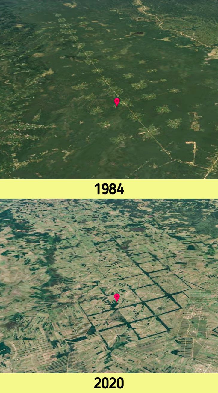
3. Clear-cutting of forests: soybean cultivation in San Julián, Bolivia
© Google Earth
In recent years, the Amazon has been one of the areas most affected by climate change. And we’re not saying this just because of the well-known wildfires affecting this part of the world, but also because of the massive logging that has been taking place on the land to develop an agricultural zone, as you can see in the picture above. Most of this new space is used to make plantations that are mostly focused on farming soybeans for cattle feed.
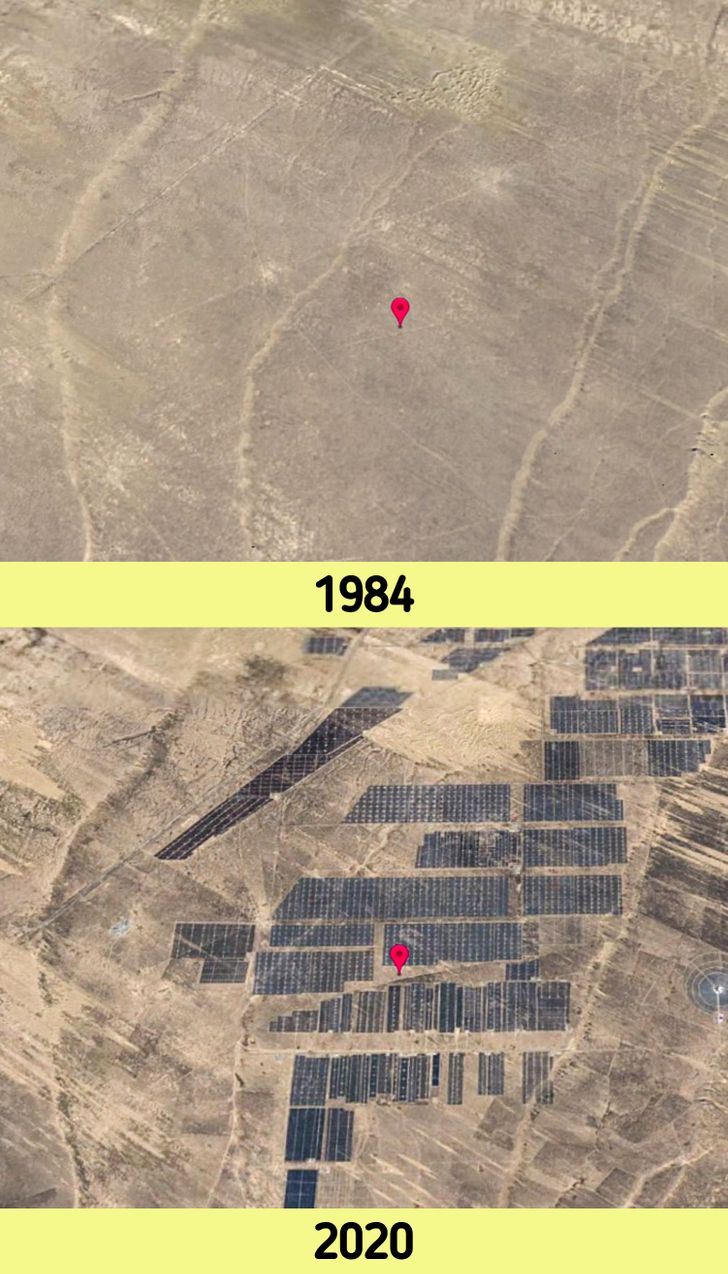
4. Fighting global warming: China’s solar photovoltaic power plant
© Google Earth
Renewable energies are energy resources obtained from nature in a clean and environmentally-friendly way. They do not produce pollutants and they help to curb global warming in general. More and more countries are betting on the use of this type of energy and are creating solar parks in their territory: China, the United States, Japan, and Germany are at the top of the list and we hope that many more will soon join them. In the pictures above you can see one of the solar plants built by China to create electricity by using the light of the Sun as a resource.
5. Melting glaciers that are gradually disappearing: the Columbia Glacier in the United States

© Google Earth
This glacier, located on the southern coast of Alaska, is one of the most affected by the temperature changes that our planet has been suffering in recent decades, mainly due to global warming. In fact, it’s one of the fastest moving glaciers in the world, and has been retreating since the early 1980s.
6. A new environmental enemy in full swing: Canada’s oil sands deposits

© Google Earth
This is one of the most damaging aspects of human activity for our planet. That’s because fracking involves extracting oil from these sands and it actually requires using a great deal of energy and water. Not only that, but it also releases a large amount of toxic and polluting agents into the water and even the air. Oil sands are a non-conventional source of oil. They’ve become a strategic resource and, in fact, their exploitation is becoming increasingly common. That’s because conventional oil, although easier to extract, is becoming increasingly scarce.
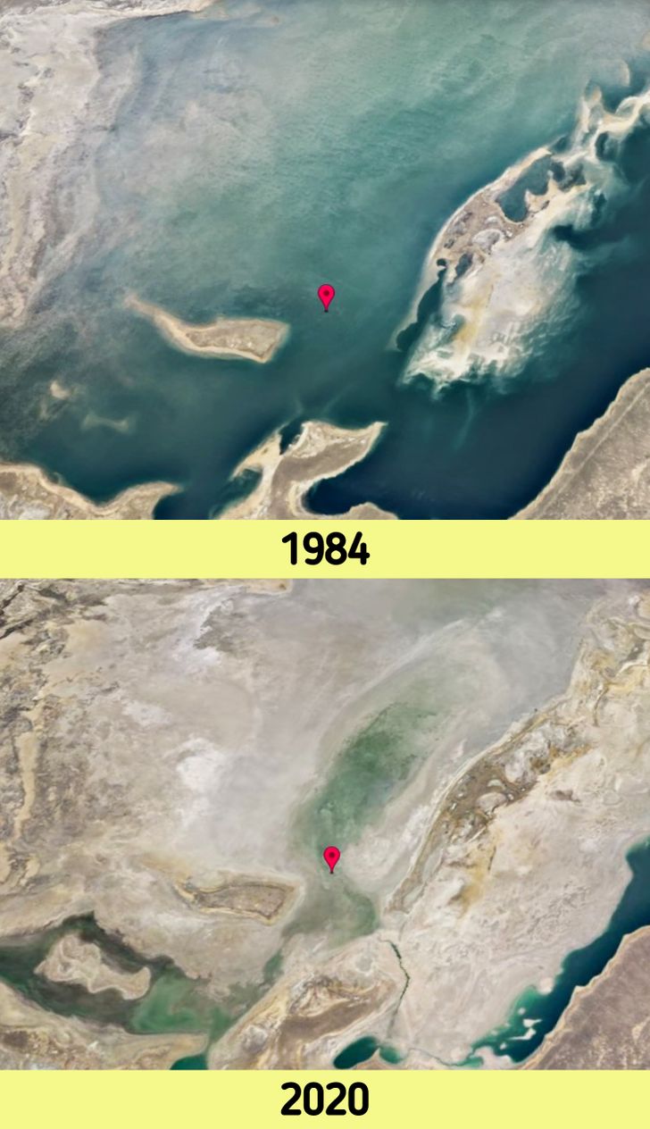
7. Industries that shrink lakes as they grow: the Aral Sea, between Kazakhstan and Uzbekistan
© Google Earth
This is another clear example of how destructive human greed can be. In 1960, a project was undertaken to divert and channel water from the Aral Sea (which despite its name is actually a lake) to produce cotton and other crops in the middle of the desert. This project ended up drying up the lake almost completely as cotton is one of the largest water consuming crops in the world.
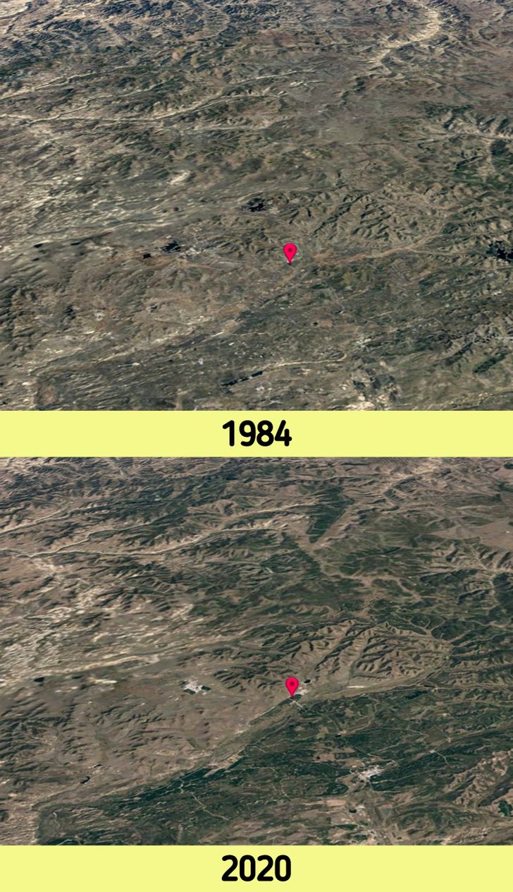
8. New green lungs for the planet: China’s Great Green Wall
© Google Earth
Hopefully, in the next 4 decades, we will see more of these kinds of transformations in the landscapes that have been affected by human activity. What can be seen in these images is the restoration of an ecological reserve that had been drying up during the last century in China. This initiative, called the “Great Green Wall” as a reference to the wall built back in the 7th century, aims to slow down and even reverse the desertification of the land by planting billions of trees throughout the area.
9. What happens in Las Vegas doesn’t always stay in Las Vegas: Growing cities in Nevada, U.S.A.

© Google Earth
Over the past 4 decades, the city of Las Vegas has increased its population by approximately fivefold. But such a big expansion requires resources too. Lake Mead supplies most of the drinking water in the area. With the city’s population growth, along with other factors like agriculture and rising temperatures, the lake has steadily decreased in size over time as you can see in the pictures above.
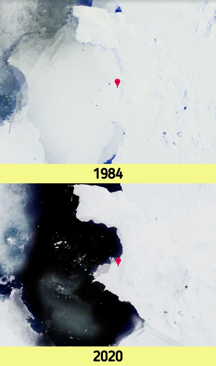
10. Antarctica slowly thawing: Pine Island Glacier, Antarctica
© Google Earth
This large ice stream that can be found on the Antarctic continent is also being greatly affected by global warming. The U.S. National Science Foundation estimates that if this glacier were to melt and discharge its meltwater into the ocean, the sea level would rise by about 61 meters. Unfortunately, the Pine Island Glacier the fastest melting glacier in Antarctica and it’s responsible for about 25% of Antarctica’s ice loss.
11. When nature destroys and then rebuilds: the natural recovery of Mt. Pinatubo, Philippines

© Google Earth
After 500 years of being dormant, the Pinatubo volcano became active again in 1991, producing one of the most violent volcanic eruptions of the last century. Its effects were felt all over the world: a layer of sulfuric acid surrounded the entire globe, temperatures dropped significantly and the ozone layer suffered extensive damage. Today we can see how the area has gradually recovered its natural aspect after the destruction caused by the volcano’s eruption.
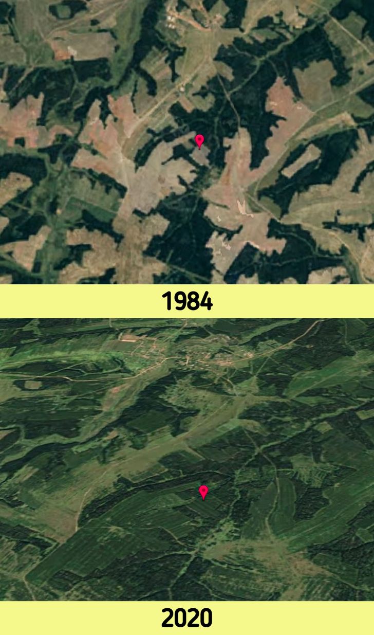
12. Abandoned crops transformed into lush green forests in Russia
© Google Earth
After the dissolution of the Soviet Union, large crops were abandoned and left again in the hands of Mother Nature to take back what was originally hers. She, by her own means, took care of restoring and recovering all the green they originally had. This was surprising, even to most scientists, who predicted that the recovery would be much slower.
Where in the world are you reading this article from? What natural wonders are present in your city or country?

